
Land Survey for Fence Projects on Corner Lots
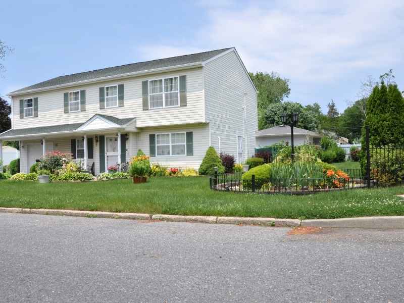
Corner lots look simple from the street. Two sides face public roads instead of one. But that setup can trip up even a careful homeowner planning a new fence. A land survey for fence projects gives you the real boundary lines before you dig a single post hole. This matters most on corner lots, where guessing wrong can mean building on land that isn’t yours, or missing space that actually is. Below, we’ll walk through what a survey checks on a corner lot, one piece at a time.
Locating Both Street-Facing Property Lines on a Corner Lot
An interior lot usually has one line that matters most, the one facing the street. A corner lot has two. Both of these lines run along a public road, and both need to be located before a fence goes in.
This double frontage makes corner lots trickier than they look. On an interior lot, the side and rear lines often feel more predictable, since they usually run straight back from the street. A corner lot doesn’t work that way. Both street-facing lines have their own shape, their own distance from the road, and their own relationship to the corner itself.
A land survey pins down both of these lines with real measurements. This gives the property owner two solid edges to build from, instead of one clear line and one uncertain guess.
Distinguishing Property Boundaries From Public Right-of-Way Lines
Here is something a lot of homeowners get wrong. The edge of the grass, the sidewalk, or the curb isn’t always the property line. Cities often own a strip of land beyond the private lot, called a right-of-way. This strip can extend several feet past what looks like “your yard.”
On a corner lot, this issue shows up twice, once along each street. The lawn might stretch out further than the actual property, making the true boundary sit closer to the house than it appears. Or the opposite might be true, with private property extending further than expected.
A survey clears this up. It shows exactly where the private parcel ends and the public right-of-way begins, along both street frontages. This alone can save a homeowner from building a fence too far forward, which often means moving it later.
Checking Corner Monuments Before Setting the Fence Layout
Every recorded parcel has boundary monuments somewhere. These might be metal pins, concrete markers, or other fixed points set during an earlier survey. On a corner lot, these monuments matter even more, since they help define where two street-facing lines actually meet.
A surveyor searches for these monuments and checks whether they still line up with the recorded boundary. This relies on real survey evidence, not on landscaping, utility boxes, or a neighbor’s old fence line. Those features might sit close to the boundary, but they were never meant to define it.
Once the monuments are found and confirmed, they become the anchor points for the entire fence layout. Corners get set from these fixed points, not from a rough guess based on what’s nearby.
Mapping Sight-Distance Areas Near Street Intersections
The corner closest to the intersection deserves extra attention. Drivers turning onto the street need a clear view of oncoming traffic, and a tall fence placed in the wrong spot can block that view.
A land survey locates the exact property corner near the intersection, along with nearby street features like curbs and sidewalks. This gives property owners and fence designers the information they need to check applicable visibility or sight-distance rules for that specific corner.
This isn’t just about following a rule. A fence placed too close to the intersection, even one that technically sits on private property, can create a real safety issue for drivers and pedestrians. Knowing exactly where that corner sits helps avoid that risk before construction starts.
Using the Land Survey to Plan Fence Corners, Gates, and Street-Side Runs
Once the boundaries, right-of-way lines, and monuments are all confirmed, the survey becomes a reliable base for the actual fence design. This is where property lines turn into a real, buildable plan.
Corner posts get placed based on the confirmed property corners, not estimated ones. Gate locations can be chosen with confidence, since the owner knows exactly how much usable space sits along each street frontage. Long runs of fence along both roads can be laid out in straight, accurate lines instead of a rough approximation.
This ties everything together. All the earlier survey work, the boundaries, the right-of-way check, the monuments, and the sight-distance corner, feeds directly into a fence plan that fits the actual shape of the lot.
Frequently Asked Questions
Why is a land survey helpful before installing a fence on a corner lot?
Corner lots have boundaries along more than one street frontage. Accurate property-line information is especially useful before deciding where the fence should sit along each of those frontages.
Does the curb or sidewalk show the property line on a corner lot?
No. Curbs and sidewalks don’t necessarily line up with private property boundaries. A survey can identify the actual parcel line as well as the adjoining public right-of-way.
Can a land survey show the public right-of-way along both streets of a corner property?
Yes. Applicable survey records and field measurements can be used to show how the parcel boundaries relate to the street rights-of-way on both sides of the corner.
Why can the intersection corner affect where a fence is planned?
Fences near intersections may need to account for applicable visibility or sight-distance requirements. Accurate location information around that corner helps property owners plan around those rules.
Can an existing neighboring fence be used to determine the boundary of a corner lot?
No. An existing fence is just a physical feature. It shouldn’t be assumed to mark the legal property boundary without supporting survey evidence to back it up.